ALL THINGS NEBRASKA
All Things Nebraska
All Things Nebraska: Where Insight Meets Impact
All Things Nebraska is an online platform, provided by Nebraska Extension, designed to support decision makers in accessing, analyzing, and visualizing data about all 93 Nebraska counties.
Our goal is to provide up-to-date, quality data across sectors to our stakeholders. From business and industry, nonprofits, governments, researchers, and Extension staff, All Things Nebraska is a place for you to find data.
Contact the All Things Nebraska team to schedule a demonstration or share feedback.
Explore the Data
Maps
Create an interactive map in the Nebraska Map Room or explore a starter map.
Reports
Create an interactive report for your community or service area.
Tools
Explore additional data, tools, and resources on All Things Nebraska and beyond.
Discover resources by topic — choose a category to see related maps, tools, and reports.
Project Spotlight
Explore featured data, tools, resources, and news.
-
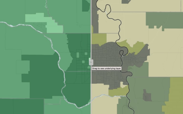
 MAP
MAPBroadband Access
This map displays broadband access as reported by the American Community Survey and as reported by the Federal Communications Commission.
-
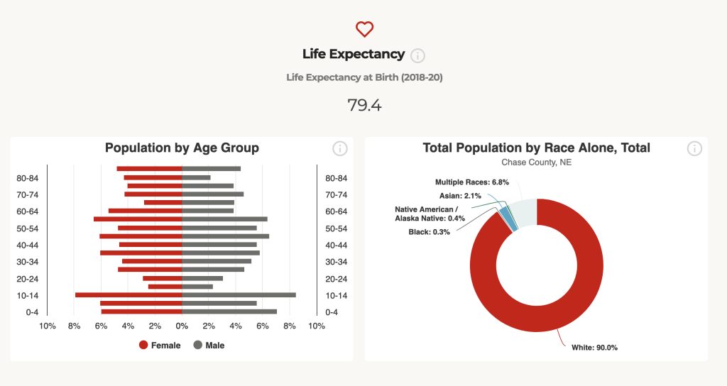
 TOOL REPORT
County Report Cards
The Nebraska County Report Cards provide population, income, workforce and other related data for every county in Nebraska. The Report Cards can be easily downloaded and shared.
-
 TOOL
TOOLNebraska Rural Poll
Explore the views of rural Nebraskans about issues such as well-being, civil discourse, artificial intelligence, housing, economy and trade, and their communities.